Monday, December 30, 2013

First major snowstorm of 2014 on its way... maybe!

Snowstorm at midnight - State Street, Amherst MA (2013)
Photo by Joshua Wolfsun
Update as of Tuesday, 12/31/2013, 5:57 AM: Having gone out on that proverbial limb to predict our getting lots o' snow (potentially) on Thursday into Friday (see below), let me also be the first to note that the most recent models tend to be taking the system further off shore, which would mean less snow for us and more for the coast. There's a storm, for sure, but whether it will dance over us is more the question.

We've already had plowable snow twice this season, but if the computer models have it right, our first storm of 2014 is going to be a memorable one. We're still three days out from Thursday, when the snow will be starting, but even now the GFS and Euro computer models have begun to align, particularly in terms of what we can expect around here in Hampshire County (and the surrounding areas). And that is, essentially, a significant amout of snow - as much as 12-18 inches by the time things wind up on Friday! Though there's still some uncertainty about the impact of this storm on coastal areas and other parts of New England, our region appears to be pretty solidly in the center of the action this time around. Right now, it looks like the snow will start around mid-morning to early afternoon on Thursday, although the heavy snows won't arrive until late Thursday continuing through much of the day on Friday. This will be a long duration storm, with plowable snow and very cold temperatures (so no chance of any kind of precipitation but snow). Things could change (we still have a number of days to watch things develop), but even Matt Noyes, NECN meterological guru, wrote just today, "High-end guidance supports a couple of feet for much of New England in an all-out blizzard." Which is just fancy speak for it's possible we could have an all-out blizzard around hereSo when you're out and about tomorrow preparing for your New Year's Eve festivities, don't forget the bread and milk along with the champagne and chocolates. Have a wonderful New Year, and keep those shovels handy!

Monday, December 16, 2013

When, Where and How Much Snow on Tuesday?

Sign of things to come this winter?
(Photo from February 2011, by S.Vardatira)
Confused about the conflicting predictions for Tuesday's storm?  While it's true that over the weekend it was looking pretty minor, by late Monday the computer models aligned around something a little more substantive for our area. Here's what we know:

By Tuesday, a storm system will be moving into the area from the west and intensifying offshore of Southern New England. The storm will bring plowable snowfall and a general snow accumulation of 2-5" to much of Southern New England. Winter Weather Advisories are in effect for our area and almost all of Massachusetts, except for Cape Cod and the Islands where a mix of snow and rain will keep amounts lower and in the coating to 2 inch range. Impact on our morning commute should be minor, with snow starting near the end of or just after the morning commute. The evening commute will likely see direct impact.

The uncertainties with this particular storm surround how much moisture is associated with the system and when and how quickly the storm intensifies. But, in general, a 2-5 inch snowfall is likely across Western Massachusetts, although - and this is where it gets interesting - models are also hinting at the potential for a heavier band of snow to setup within the Winter Weather Advisory area (which includes us). If this were to occur, it could create an area of snowfall greater than 5 inches in some places within this area. The timing of the heavier snow band formation could be during the late afternoon and into the evening. We'll keep an eye on things, of course, and let you know what develops. And as always, stay safe out there!

Sunday, December 15, 2013

Alberta Clipper Headed Our Way for Tuesday

Snow Glitter, Amherst MA
(Photo by S. Vardatira) 
Now that you've cleared the snow off your driveways, cars, and walkways, and have finally settled in for the evening, I thought it would be the perfect time to let you know that, uh, more snow is coming. An Alberta Clipper is forecast to come through on Tuesday, bringing along a few more inches - around 3". Everything warms up a tad - up to 43 degrees - for the end of the week and weekend before dipping back below freezing. Even with some melting, there's enough around that a white Christmas seems likely!

By the way, the official snow total for North Amherst, as of 7 am this morning was 6.8 inches.

Saturday, December 14, 2013

First Snow Excitement

Screen shot from Facebook feed today, 12/14/2013 - at about 8am
(Click on image for clearer detail)
Just want to mention that the weather community's excitement at having a bona fide, gathering winter storm to report on is palpable and infectious. Live reports, computer generated isobar maps flying all over the place, Skywarn alerts, warnings up, and predictions at every turn. You have to remind yourself that it's likely only 6-10 inches of snow, really nothing we haven't seen or dealt with before. And then, once you've done the grown-up reality-check thing, just enjoy. We are about to be blanketed in fluffy, soft flakes of crystalline water - what's not utterly amazing about that? (Hey, it's still the first snow... no need to look further ahead than that!)

Friday, December 13, 2013

Talkin' Winter Storm Warning

Contemplating the first snow
(Photo by M.D., Amherst MA - 2/2013)
All week, you’ve been hearing that something big is on the way. Most likely you’ve also been spreading the news. Let’s face it, talking about the weather is a way of life in New England – and when a storm is brewing, it’s topic number one everywhere. I was reminded of this on Tuesday, when I stepped onto an elevator and into this four-way conversation:

Person #1:     Cold enough out there for you?
Person #2:     Brrrr. So cold.
Person #3:     Getting colder the end of the week.
Me:                 By Thursday, it’s going to feel like the Arctic.
Person #3:     You hear about the storm coming this weekend?
Person #2:     Of course. We might get a foot.
Me:                 First big storm of the season, in December no less.
Person #3:     What does that mean for the rest of the season?
Person #2:     Get out the shovels.
Person #1:     Hey, we got shovels. This is New England, after all.

Get out the shovels indeed. Now the thing we’ve been talking about all week is official – a Winter Storm Watch has now been issued for our area, as well as most of Massachusetts, Connecticut, Rhode Island, and New Hampshire. Snow is expected to overspread southern New England starting late Saturday afternoon, becoming steadier and heavier Saturday night into Sunday morning before tapering off Sunday afternoon. Although the Amherst area is most likely to see an all-snow event, snow will likely change to sleet and freezing rain for a period of time from late Saturday night into Sunday morning across Connecticut, Rhode Island and possibly as far north as the Mass Pike including the Greater Boston area.

[NOTE: Update as of Friday evening, 12/13: 
Our winter storm watch is now a winter storm warning. In effect from 1 pm tomorrow, Saturday, until 1 pm on Sunday. Predictions are for 6-10 inches around our area. Note that this is slightly earlier than previously forecast, so you may want to get your essential activities out of the way earlier in the day if possible. Snow is expected to overspread the region by afternoon, though the heaviest will fall in the overnight hours.]

This is a classic nor’easter, so this system will also bring winds from the northeast of 15-25 MPH with gusts up to 35 mph. The strongest winds will be in the coastal areas, across Rhode Island and Eastern Massachusetts. Meanwhile temps will be in the 20s but rising into the lower and mid-30s across Rhode Island and Eastern Massachusetts where visibility will also be significantly reduced due to wind and heavy snow.

Although there is still some uncertainty about how much we will get here in the Pioneer Valley, the forecast is currently predicting 6-12 inches. One thing is definite – travel will become difficult and treacherous by late Saturday, so plan accordingly.

Snowfall probability for the weekend, as of Friday morning
National Weather Service, Taunton Office
Look for our Winter Storm Watch to become a Winter Storm Warning over the next day, as we get closer to the main event.

Monday, December 9, 2013

Top Gifts for Weather Enthusiasts (updated for 2018)

If you are looking for that perfect gift for the weather enthusiast in your life (or yourself), look no further. Updated for 2013, our Head in the Clouds Amherst list of “Top Gifts for Weather Enthusiasts” includes THE BASICS (essential tools for the weather watcher), BOOKS AND CALENDAR, and BEYOND BOOKS AND BASICS (for the weather enthusiast who has just about everything else). With a few exceptions, we have focused on the more affordable items out there, with most under $100, and many under $30.

THE BASICS (core requirements for the weather obsessed)

1. Weather Station (under $30 to over $1,000)
A must-have for any weather enthusiast, the home weather station can be purchased for a range of prices, from under $30 to upwards of $1,000. For an affordable weather station, we recommend Ambient Weather’s most popular desktop weather station; it costs $66 and is packed with features. The unit uses an outdoor sensor to monitor both indoor and outdoor temperature and humidity, outdoor dew point, as well as barometric pressure (both sea-level and measured), and features a pressure history chart to track trends (barograph). The forecast icons let you know at a glance if it’s going to be rainy, cloudy, or sunny based on barometric pressure trends.

2. Rain Gauge ($5 to over $100)
Rain gauges can be purchased for under $10 to over $100. Those of us who are accustomed to walking outside to get a visual reading will surely appreciate the newer, high tech wireless models. (I for one can’t possibly justify purchasing one for myself, but I wouldn’t return the gift if one came my way!)  Wireless models like the one we’ve linked to icollect data then transmits via a wireless signal to the included console. The console displays many weather variables such as; the daily rainfall, indoor/outdoor temperature and indoor/outdoor humidity. A storm alert indicator will display whenever there is a drop in the barometric pressure which signifies the possibly of an approaching storm. And all that for $50 (on sale now). Of course, you can also get a basic, plastic rain gauge from your local hardware store for less than $5. It makes a great stocking stuffer, and it also comes with the added exercise benefit of forcing you to walk outside to get a reading.

3. Hand-Held Wind Meter (under $100 to over $1,000)
Like the weather station, hand-held anemometers come in a wide range of prices from under $100 to over $1,000. The most basic ones, like the one we’ve linked to here for $74, will allow you to measure wind speed (and sometimes temperature), while the pricier ones provide a whole range of other features, such as heat stress meters, hygrometer, digital compass, onscreen notification of dangerous conditions, ballistics meters, etc.  For most of us, the lower tech models will suffice just fine, and they can be purchased for under $100 (you can probably even find them on eBay for under $20). This is the perfect piece of equipment, not just for the weather obsessed, but also for model plane pilots, wind surfers, and other outdoor enthusiasts that rely on accurate wind speed information.  


There are numerous variations of the emergency alert radio, but regardless of what you end up with, make sure it enables you to access an alternative power source (such as a hand crank). We like this model for its versatility – it includes a flashlight, AM/FM Radio, 4 sources of power (alkaline batteries, AC adapter, crank, or rechargeable battery), alarm clock, and thermometer with freeze alert. It can also be charged from a USB connector. The digital tuner accesses news and weather information, and it also has an alert mode, which will activate the weather band while in standby mode when a weather alert is active in the local area. 

5. Twister (the Movie) (DVD, $14.00)
This is such a basic weather enthusiast experience that we actually hesitated to include it here – seriously, is there anyone among us who has not seen this film more times than we can count?  However, on the off chance that your weather enthusiast doesn’t actually own Twister, let this serve as a strong recommendation.  Directed by Jan De Bont (director of Speed), Twister is our favorite natural disaster film ever.  The story centers around a day of record-breaking tornadoes in Oklahoma and a storm chasing team’s attempts to deploy DOROTHY (a gizmo designed to release thousands of tiny sensors when a tornado passes over it) in hopes of recording scientific evidence and devising an earlier warning system. The team is led by former romantic partners Jo (Helen Hunt) and Bill (Bill Paxton), and the supporting cast includes Cary Elwes and Phillip Seymour Hoffman.  There are laughs along the way, and quotable lines abound. As one reviewer commented, “The skies are threatening, the landscape sweeping, and cows and tractors flying through the air will remind you of that other famous Hollywood cyclone. No one ends up in Oz here, but Twister has a magic all its own.”

Books & Calendar

6. Soul of the Sky, ($12.95) compiled and edited by: Dave Thurlow & Ralph Adler
Soul of the Sky is a different kind of weather book. It’s not preoccupied with charting fronts, defining what an isobar is, or trying to get you to memorize the conversion formula from degrees Centigrade to degrees Fahrenheit. Instead, it's a collection that illustrates how the weather can inspire and terrify, connect and urge us on to new adventures, and invite us to gain a deeper appreciation of how weather and climate affect our everyday lives. This take on weather is close to our hearts here at Head in the Clouds Amherst. The anthology includes essays by a wide variety of renowned and some less-known authors. Published by Mount Washington Observatory, this paperback is a solid 150 pages. Can also be purchased from Barnes and Noble, Amazon, and other sellers.

7. Cat in the Clouds (16.99), by Eric Pinder with illustrations by T.B.R. Walsh
In this children’s book, stray cat Nin drifts from house to house until he meets a meteorologist named Mark. Then Nin begins his greatest journey yet- to the top of Mount Washington. Readers follow Nin to a land where the wind howls, snow swirls and wild bears roam. At the Mount Washington Observatory, Nin learns that  a wonderful home can be found anywhere, even high above the clouds. Hard cover, 32 pages, softcover, and is also free with Kindle Unlimited.

8. The Art of Weather Photography – A Comprehensive Guide for Beginners: Capture Weather Photographs Like a Professional ($7.99 Kindle; $8.99 Barnes and Noble; and also available through other booksellers), by Jacci Ingham. 
Australian Weather and Nature photographer, Jacci Ingham, shares her passion for chasing storms and reveals her secrets of mastering the art of weather photography. In this comprehensive guide, Jacci provides everything you need to know about capturing your own landscape and lightning images. She explains the equipment used, and details the camera settings for the various times of day and meteorological conditions. This book is suitable for all ages. It contains a useful glossary to help the novice reader and covers definitions of common terms, acronyms and popular jargon used by storm photographers

9. Weather Forecasting Quick Reference Card ($9.99, Davis Instruments)
This handy plastic card shows the use of wind direction, barometric pressure, and cloud type in predicting the weather, plus a full list of radio weather stations for official broadcasts, key information on storm warnings, hurricane avoidance, navigating in fog and other hazardous conditions, and more. Weatherproof high-strength plastic, full color both sides. Punched for binder or bulkhead mounting.
Dimensions: 8½" x 11" (216 x 279 mm).

10. Head in the Clouds Amherst 2019 Wall Calendar  ($17.80 per calendar, and can be ordered directly from this link)
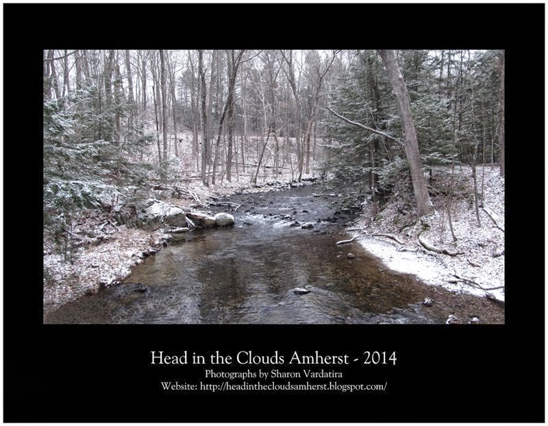
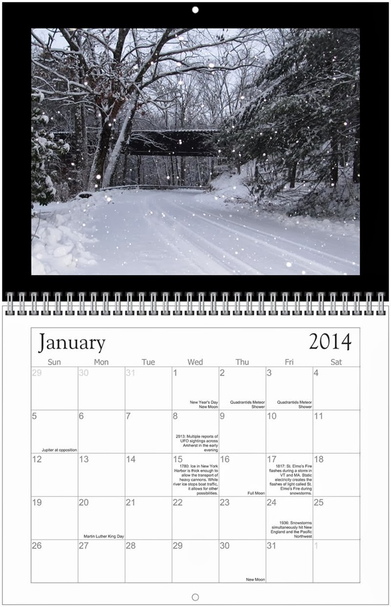
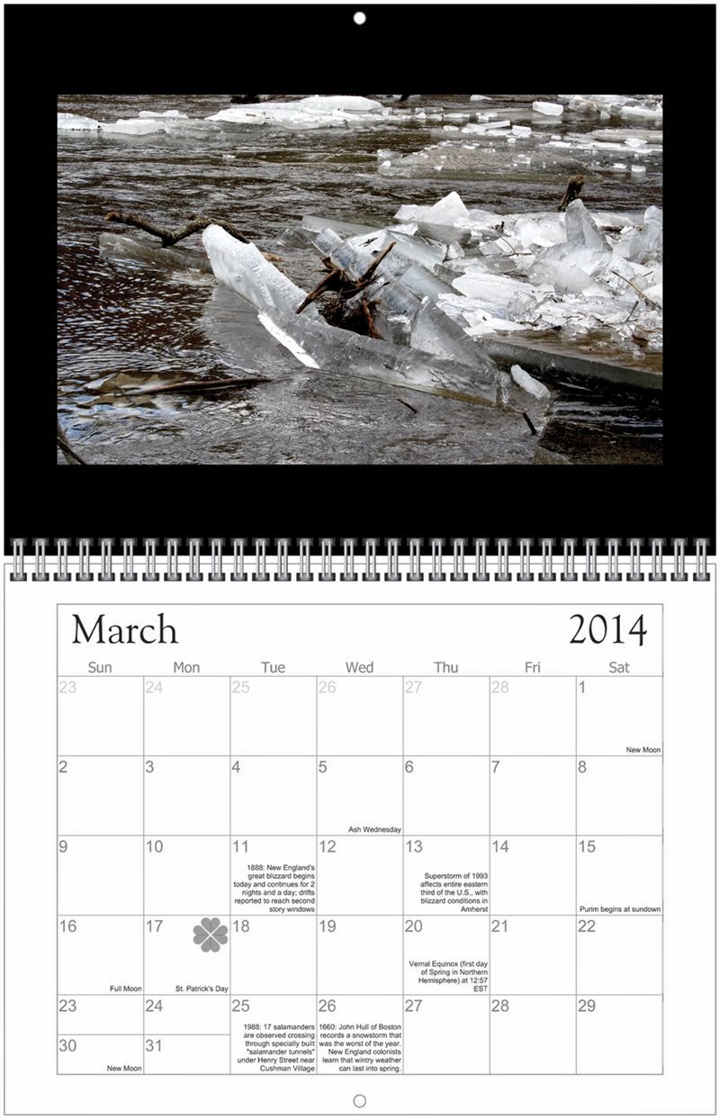
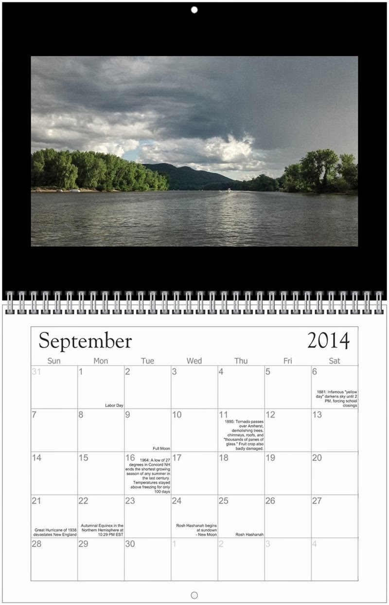
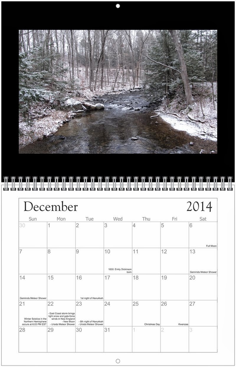
This is a bit of shameless self-promotion of our own limited-edition calendar, but we’re pretty sure you’ll have no trouble finding the weather and cloud calendars that can be purchased far and wide everywhere. In the meantime, we offer you something unique and specific to our local area. New this year, the Head in the Clouds Amherst 2019 Wall Calendar features 12 nature photos taken in Amherst by local residents and visitors. In addition, our calendar notes major holidays, as well as astronomical events visible from North America with the naked eye (full moon, new moon, meteor showers, and more). And, in a unique twist that you won't find anywhere else, our calendar also documents over 60 major weather events that occurred in Amherst and New England between 1660 and 2018. Full size when open is 17" high and 11" wide.  Buy here ($17.80/calendar, including postage) for delivery by mail, or purchase at Hastings or Simple Gifts Farm Store (in Amherst MA). 

BEYOND BOOKS AND BASICS
Unique, unusual and over-the-top gifts for the weather enthusiast who has everything else!

The StrikeAlert II is one of the most affordable and easy-to-use personal lightning detectors. It provides an early warning of approaching lightning strikes from as far away as 40 miles. An audible alarm sounds when there's a strike, and a corresponding LED light illuminates accordingly at lightning distances of 20-40 miles, 12-24 miles, 6-12 miles and within 6 miles. The detector is housed in a small pager-like casing that can be clipped on a belt loop and runs on two AAA batteries.  This allows the user to see all the lightning activity within a 40 mile range, giving clearer visibility to the nearest strike in the last two minutes. Perfect for weather and outdoor enthusiasts and anyone who frequents outdoor sporting and recreational events.


12. Night Sky Alerts ($5.99/month)
Astronomy Alert Service - Sign up for this service and you'll be notified when things are happening in the night sky. You'll never miss another geomagnetic storm, meteor shower, planetary convergence or visible space station flyby. Currently being used by lsky watchers in over 25 countries!.


13. Mount Washington Observatory Summit Day Trip (Members: $429 and Non-Members $499)
Summit a snow-covered peak in a day? With Mount Washington Observatory Day Trips, you can. A thrilling snowcat ride will take you to the top of the tallest peak in the Northeast where you can spend the day reveling in the mountain's legendary weather and scenery. A highlight of the visit is a guided tour of the Mount Washington Observatory's famous mountaintop weather station and the opportunity to meet the scientists living and working in this remote outpost. Then, after a hearty, homemade lunch, you'll head back down the mountain before nightfall. If you're looking a true alpine adventure in a one-day format, this is the trip for you.

14. Weather Spotter’s Field Guide ($0 if you have access to a free printer)
We here at Head in the Clouds Amherst do our best to find something for every budget. Those gifting with limited cash on hand might consider printing out some of the excellent open-source information available on the web - and giving that to the weather buffs in your life. Even if the recipient is an official Skywarn Spotter, they are unlikely to have actually read this field guide. And if they aren't an official Skywarn Spotter, even better - you can let them know how to join up by sending them here.


And after all that, if this list still isn’t enough for you, check out our 2012 Top 10 Gifts for the Weather Obsessed for more ideas (though likely many of the links are out of date by now). 

Friday, December 6, 2013

The first (accumulating) fall of snow

Snow coming soon to our neck of the woods!
(The image is real, the animation added just for fun)
Photo of Puffer's Pond, by S. Vardatira, 12/1/2013
The first fall of snow is not only an event, it is a magical event. You go to bed in one kind of a world and wake up in another quite different, and if this is not enchantment then where is it to be found?
J. B. Priestley 

Have your shovels ready, snow is in the forecast! A Winter Weather Advisory has been issued for our area for snow starting around 6 PM this evening and continuing to 6 am EST Saturday. Locations include western and central Massachusetts north of the Massachusetts Turnpike and west of I-495. Expect accumulations of 2 to 4 inches along with a trace of ice. Localized accumulations of 5 or 6 inches possible in the east slopes of the Berkshires. The precipitation is likely to start as rain, changing quickly over to sleet and then snow this evening. Brief heavy snow is possible. Meanwhile, temperatures will fall into the upper 20s - that's nearly a 30 degree drop from Friday morning to Friday night.

Wednesday, December 4, 2013

Venus and Moon Bright in the Evening Sky

Graphic from EarthSky.org
Outside RIGHT NOW - golden sliver of moon is suspended over the southwest horizon, with Venus higher than the moon and bright in the sky, same general direction. (You can't miss Venus, it's the brightest point of light out there.) And with a good pair of binoculars, you will even be able to watch the changing phases of Venus over the next few days. Although Venus’ phase is waning in the evening sky right now, the forecast calls for Venus to be at its greatest brilliance in the evening sky in a few more days.

Monday, December 2, 2013

Comet ISON, R.I.P.

Bad news for those of us who have been looking forward to seeing Comet ISON make a spectacular and rare appearance in the night and daytime sky. As reported by spaceweather.com, Comet ISON is now just a cloud of dust following it's Thanksgiving Day brush with solar fire. Experts currently believe ISON broke apart shortly before perihelion (its closest approach to the sun).

These images from NASA's Solar Terrestrial Relations Observatory and the ESA/NASA Solar and Heliospheric Observatory show the comet fading rapidly before it vanishes behind the sun's disk. It emerges as a diffuse remnant of its former self, evaporating quickly into a shadow of its former self. By the end of November 28th, Comet ISON was spent. 


As of today (December 2), the cloud of debris that once was Comet ISON is no brighter than a star of approximately 8th magnitude. Experienced astrophotographers might be able to capture the comet's fading "ghost" with a telescope in the pre-dawn sky in early December. Otherwise, Comet ISON will not be visible in the night sky this month. Now, in addition to pouring over data collected on Comet ISON as it made its way towards the sun in the past year, researchers will also be asking what exactly happened to bring ISON to its unexpectedly rapid demise.

ISON coming towards Sun (on right), and going away from Sun (on left)
(Photo by NASA)
According to the NASA website, "Throughout the year that researchers have watched Comet ISON – and especially during its final approach to the sun – the comet brightened and dimmed in unexpected ways.  Such brightness changes usually occur in response to material boiling off the comet, and different material will do so at different temperatures thus providing clues as to what the comet is made of.  Analyzing this pattern will help scientists understand the composition of ISON, which contains material assembled during the very formation of the solar system some 4.5 billion years ago."

Friday, November 29, 2013

Soon Starting the Coldest 3 Months of the Year

Snow at night, by Joshua Wolfsun
(January 2013)
"Shut the door. Not that it lets in the cold but that it lets out the cozyness." 
                                                                 Mark Twain

Here's hoping you all have plenty of cozy moments as we ride towards December 1 and the beginning of meteorological winter in the northern hemisphere. Unlike astronomical winter, which starts on Winter Solstice (December 21 this year), meteorological winter runs from December 1 to the end of Feburary, the coldest three month period of the year in the northern hemisphere.

Monday, November 25, 2013

Update on Our Thanksgiving Storm

NECN snow estimate for noon on Wednesday, 11/25
The computer models have been all over the place for the past week, but at this point (just one day out, of course) there is consensus. Here's all you really need to know about the upcoming weather: there is a huge storm headed our way, which will bring us primarily RAIN from Tuesday evening after dusk through much of Wednesday. And by rain, I mean as much as 3" of torrential rain (particularly on Wednesday) with high winds, including gusts of 60 mph, along with isolated power outages. Meanwhile, 6-12 inches of snow may accumulate in western parts of New York, PA, northern New England and the Adirondacks - but the forecast is not predicting snow in Amherst and the surrounding area. Conditions will improve dramatically from late Wednesday afternoon and on. Best traveling times are Tuesday until nightfall and late in the day on Wednesday. Expect delays through much of Wednesday.

Saturday, November 23, 2013

Will we have snow on Thanksgiving?

NECN Weather Forecast Map for November 27, 2013
(Poised to bring us snow on Thanksgiving?)
[Added 11/25/2013: See our newest update on this storm, by clicking here.]

Right now, the signs continue to point to a major storm this coming week, into Thanksgiving, though what exactly it will bring to the local area is still very much up in the air (haha, pun intended!). There are a few things that seem fairly certain:
  • This week's system will bring a lot of moisture - in the form of heavy rain, fog, low cloud bases, and snow - to New England. 
  • The storm will result from the convergence of southern moisture coming up from the Gulf and cold air which will be situated over our area.
  • A large area across the entire Eastern Seaboard will be affected from Tuesday night through Thanksgiving Day. 
  • Travel is likely to be disrupted on some of the busiest travel days of the year.
Depending on the storm track, Western Massachusetts could even get substantial snowfall (meaning more than 6"). Both the Euro computer forecast model (which in recent years has tended to be more accurate) and the Global Forecast System (GFS) are predicting snow for our area, ending on Thanksgiving night. Their only differences at this point are in the amount of snow being predicted, with the Euro model forecasting heavier amounts of snow than the GFS.

Stay tuned for more updates. And in the meantime, prepare to bundle up - an arctic cold front will plunge south through the region this afternoon, bringing windy and very cold conditions. Late Monday, a warm front will push through the region, and another weak cold front will follow on Tuesday as the major storm moves north along the Atlantic Seaboard.

Sunday, November 17, 2013

Strange weather afoot - be prepared

Summer Storm over Hadley, MA (2012)
Photo by S. Vardatira
The storm system that is producing the threat of tornadoes today in the Great Lakes region will be reaching our area later tonight through Monday morning. Ahead and along that cold front, the potential exists for strong to possibly damaging winds with a squall line or fine line of convective showers and/or thunderstorms. Brief heavy downpours are possible as well. The extent of the threat is still being evaluated, but the National Weather Service Storm Prediction Center in Taunton has placed portions of Southwest New Hampshire, Western and Central Massachusetts, Connecticut and Rhode Island in a "slight risk" for severe weather through 7 AM Monday morning and a 5% risk for severe weather through early afternoon Monday for the rest of Southern New England. The concern is that a fine line of convective showers and/or thunderstorms could bring stronger winds down to the surface.

Meanwhile, a major severe weather outbreak is expected today over portions of the Ohio Valley, Midwest and Great Lakes region starting late this morning and lasting through the evening and into Monday. Given the overnight-into-morning timing of the cold front reaching our area, the unusual time of year for a threat of convective showers and/or thunderstorms, and the uncertainty of how much of the strong winds aloft will reach the surface even in any convection, the confidence level on the impact of this event is lower than normal, but there will be the potential for isolated pockets of tree and wire damage. In other words, be prepared for some strange weather for this time of year.

Thursday, November 14, 2013

Does a sunset get more beautiful?

We've had some beautiful sunsets all week - fortunately, late this afternoon I happened to be in the right place and right time. I took both photos between 4:30-4:40 pm from Pine Street in North Amherst.


From Saturn, Earth a Pale Blue Dot

This image of Saturn released by NASA earlier this week really does drive home the fact that our planet and all of us are impossibly tiny on a universal scale (and this is just the view from our own solar system). Strange and (to me anyway) oddly comforting all at the same time. It's breathtaking to think of how much joy, misery, life can all be happening in such profusion across our planet - and that, from a distance, you'd be completely unaware, very likely never even know Earth exists.

This single image of Saturn consists of 141 wide-angle images taken by NASA's Cassini spacecraft. In addition to showing how Saturn would look to the human eye, it also shows Saturn and its inner ring system, as well as Earth, Venus and Mars, in stunning detail. 

This photo is part of the “Wave at Saturn” campaign NASA launched this past summer. Announcing that it would be shooting an image of Earth from Saturn, NASA invited the public to find Saturn in the sky, wave at the ringed planet, and share pictures via the Internet while Cassini simultaneously captured these images.  “In this one magnificent view, Cassini has delivered to us a universe of marvels,” Carolyn Porco, Cassini’s imaging team lead said of this image. “And it did so on a day people all over the world, in unison, smiled in celebration at the sheer joy of being alive on a pale blue dot.”

Photos released by NASA, November 2013
Image Credit: NASA/JPL-Caltech/SSI

Wednesday, November 13, 2013

First Ice on Puffer's Pond

First ice of season forming on Puffer's Pond, 11/13/2013, 7:30 am
(Photo by S. Vardatira)
Despite being a brilliantly sunny, blue sky morning, the day started out anything but warm. Winter has settled in the Valley (at least for a few days), and making the adjustment from the 40 and 50 degree days of last week to the plunging cold of last night and this morning is challenging. I'm not sure why it's so much easier to put up with the cold (and much colder) in mid-winter than it was this morning, but that's just the way it is. In fact, a 20 degree morning in January might not actually seem so bad. It's all relative. Other than one jogger that passed by, along with the sporadic car on State Street, not another human was in evidence at Puffer's Pond South Beach this morning. I did glimpse a duck paddling lazily in the open water near the marshes on the east side of the pond, but if there were others around, they were well hidden. Most of the trees have dropped their leaves, but a few are still hanging onto their foliage, which rustled gently in the light breezes. As I had anticipated (there would be no other reason to venture out in the cold this early!), ice has started to form near the shore and wherever the water is particularly shallow. Even from a distance I was able to identify the patches of ice by the swaths of leaves frozen on the surface. Where it's not frozen, the leaves have floated away, leaving the water dark and clear. Air temperature: 24.6°F.

Friday, November 8, 2013

Gray Skies Beautiful

Gray Sky Beautiful, Hadley MA - 11/7/2013
(Photo by S. Vardatira)
Farmhouse Under a Gray Sky, Hadley MA - 11/7/2013
(Photo by S. Vardatira)

Setting Sun, Amherst MA - 11/7/2013
(Photo by S. Vardatira)
When it comes to describing a beautiful vista, "gray skies" is not the term that usually springs to mind. But yesterday in the valley we had exactly that - starkly beautiful layers of undulating clouds in varying shades of gray (stratocumulus I would guess), stretching out from our hill-bounded horizon in every direction. I ended up ignoring my mid-day errands and work as I drove away from town and towards farmland to get a more expansive view. At one point when I had exited my car to take pictures, a police cruiser pulled up and asked if everything was okay. I nodded "everything's great," and gestured with my camera towards the sky. The officers followed my gaze, nodded in appreciation, and then waved good-naturedly as they headed on their way. "Carry on," they called as they drove off, "enjoy your day."  And so I did.

Along with Prayers and Donations, Time for Action on Climate Change


To put any storm we may experience this winter into perspective, Super Typhoon Haiyan just crashed into the Phillipines with sustained winds of 195 mph and gusts as strong as 235 mph, making it probably the strongest tropical cyclone to hit land anywhere in the world in recorded history. More than 125,000 people nationwide were moved to evacuation centers, and damage is likely to be significant. Last year, December's Typhoon Bopha, with sustained winds of 175mph, killed 1,100 people in the country, and, compounding the misery and loss, just last month an earthquake hit the central Philippine island of Bohol, killing 222 people. The Philippines is considered one of the most vulnerable countries to climate change. So in addition to holding good thoughts and prayers for everyone affected, we can also help by contributing to relief efforts and urging U.S. action on climate change.

Once it passes through the Philippines, Haiyan is likely to head back out into the South China Sea over the weekend, where it may well strengthen once again before heading toward the Vietnamese coast.


Thursday, October 31, 2013

Seeking Halloween 2011 Storm Pictures

Do you have a great pic of our Halloween storm two years ago? Email them to Head in the Clouds Amherst. Our favorite will be posted to our new "picture of the week" column (will go up in November) - and the winner will receive a FREE Head in the Clouds Amherst 2014 Wall Calendar! Click here and go to the bottom of our "About Us" page for our email. We will be issuing a new photo search challenge every week, with a free calendar for each winner (non-locals will only need to pay postage), so check back frequently!

Witches Welcome (snow not so much) - October 30, 2011, Amherst MA
Photo by S.Vardatira

An eerie fog before the Halloween storm

Front page of Daily Hampshire Gazette, 10/31/2011
It may have first hit on October 29, 2011, but the "snow-tober" storm of two years ago was far from resolved by Halloween of that year. This was the front page of the Daily Hampshire Gazette on Halloween 2011. Ask any local resident about that time, and you will hear some amazing tales. Trick or treating was postponed in Amherst, power was out for many of us (some of us would not have it restored for days yet), and roads throughout town were still impassable due to fallen trees and branches. Nothing like that this year, fortunately.

But apparently we cannot have Halloween without some kind of storm descending upon us, though this one won't approach what we've experienced the past two years. Still, at this moment an eerie Halloween-appropriate fog has descended over the valley, ahead of a storm that will be bringing us high winds and rain overnight tonight and into Friday. Eastern Massachusetts and Rhode Island are likely to get damaging winds, rain and possibly flooding. In fact, a high wind watch is now in effect from late tonight through Friday afternoon for Barnstable, Bristol, Plymouth, Norfolk and Suffolk Counties of Massachusetts for sustained winds of 20-35 MPH with wind gusts of 50-60 MPH. Our own area is likely to see wind advisory conditions.

This storm system, which is tracking through the Great Lakes and Southeast Canada, will bring much warmer temperatures for a period of time along with the high winds and brief period of heavy rainfall. As some trees still have a fair number of leaves on them (that was a problem in 2011 as well), this could cause isolated to scattered pockets of tree and wire damage and power outages. Flooding will be compounded by leaf clogged drains.

For now, I intend to take a walk in the fog. Enjoy your Halloween festivities - and stay safe out there tonight.

Wednesday, October 23, 2013

2014 Head in the Clouds Amherst Calendar - Now Available!

(Click on image for enlarged view)
Our first ever, Head in the Clouds Amherst 2014 Wall Calendar features 12 of your favorite nature photos from our blog, all taken in Amherst and the surrounding area. Printed on high quality, glossy paper, this calendar notes major holidays, as well as astronomical events visible from Amherst with the naked eye (full moon, new moon, metor showers, and more). And, in a unique twist that you won't find anywhere else, our calendar also documents nearly 40 major weather events that occured in Amherst and New England between 1660 and 2013. A perfect gift for friends and family, this calendar will delight and surprise month after month. Full size when open is 17" high and 11" wide. 

Buy here ($12.50/calendar) for delivery by mail, or purchase at Amherst Books or Hastings. Amherst Books is located at the center of downtown Amherst at 8 Main Street, and Hastings is also downtown, at 45 South Pleasant Street on the Common.